


Canada’s Most Beautiful Road Trip? 16 Must-See Sights on the Sea to Sky Highway.
There are more than a dozen places you won't want to miss.
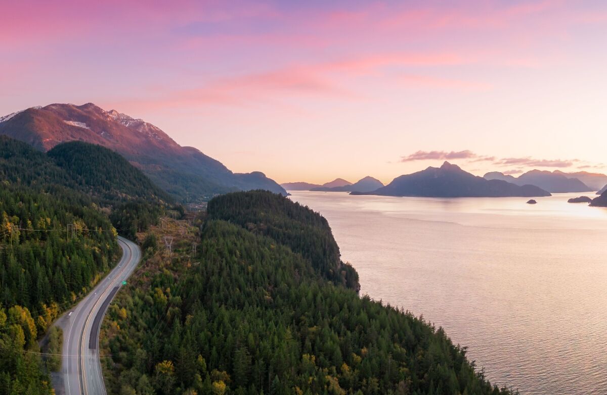
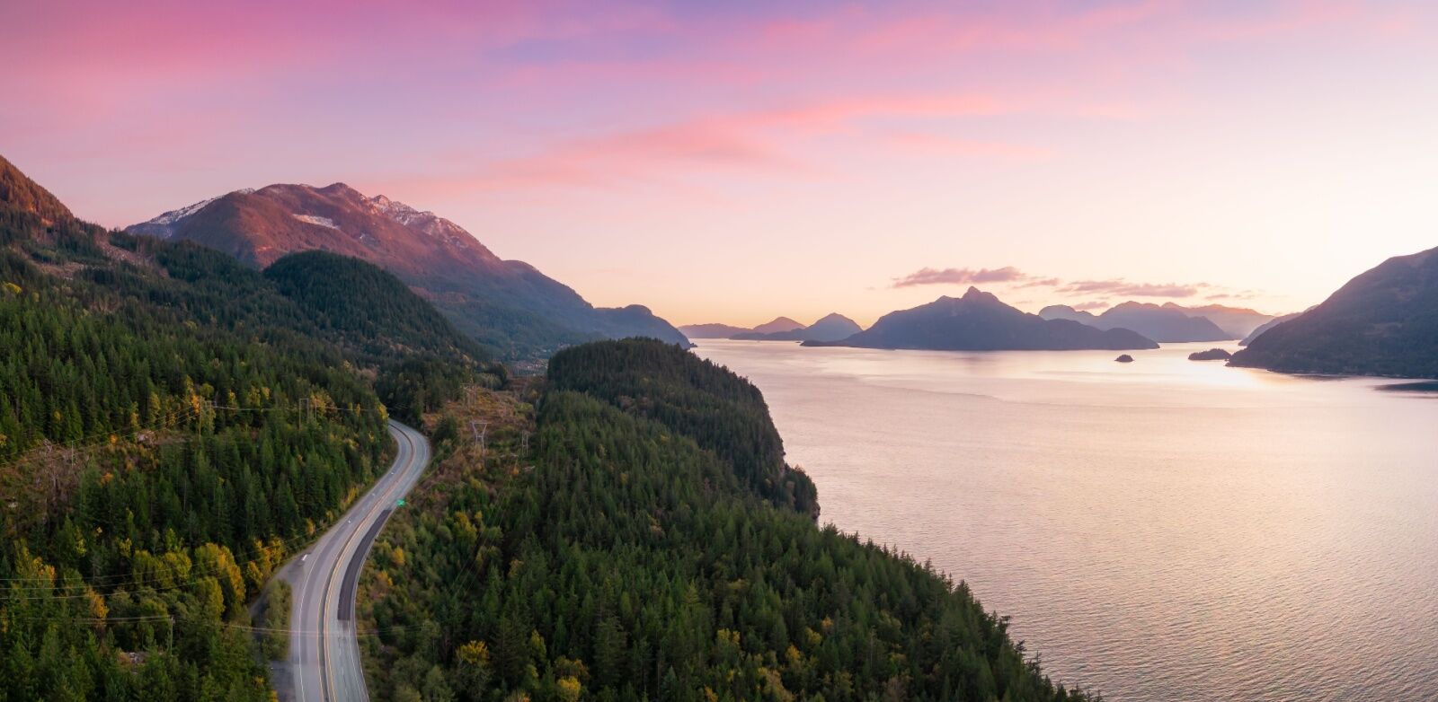
Here’s a secret that’s really not a secret at all: British Columbia is absolutely gorgeous.
I’ve been a big fan of British Columbia for years and years, and try to make as many trips up there as I can. I’ve stayed at a luxury wilderness lodge on Vancouver Island, gone on a grizzly bear safari at remote Tweedsmuir Park Lodge near Bella Coola, and snorkeled in a flowing river with salmon near Tofino. I’ve had the best backcountry ski day of my life in Whistler (really!), hiked off-the-map trails in North Van, and been the Strava local legend on more Squamish bike trails that I can count. I’m so obsessed with Squamish that my husband and I got married there, and go back for a few weeks a year whenever we can to whip our butts into bike shape for the season. And it doesn’t hurt that we love rock climbing, too.
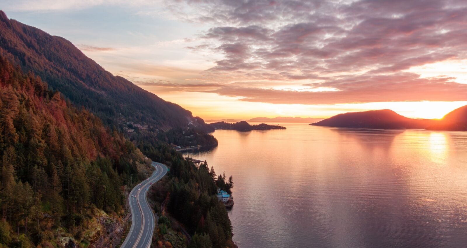
Photo: EB Adventure Photography/Shutterstock
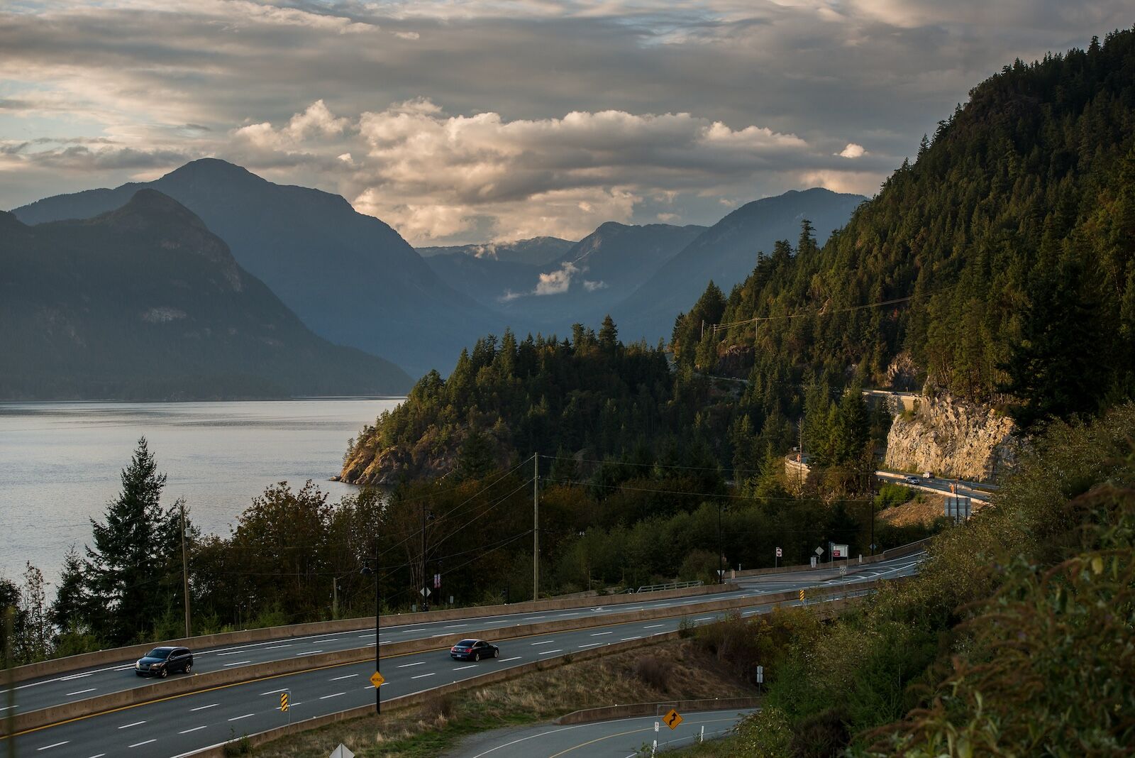
If you know any of those destinations, you probably know what road connects them: the gorgeous Sea-to-Sky Highway. Needless to say, I’ve driven it more times than I can count, in everything from slow and snowy winter conditions to summer sunset drives where it feels like bald eagles are soaring just feet above my windshield. At only 101 miles, it’s not a particularly long drive, but it’s easy to make the argument that it’s one of the most beautiful stretched of road in the world. The winding, coastal road passes everything from beaches to waterfalls to glacier-covered mountains, and I would dare anyone to drive it without saying “woah” at least a dozen times. Even if you make absolutely no stops at all, you’ll still have amazing views from the passenger seat of the car.
Here’s where I recommend stopping on the Sea to Sky Highway during a summer or fall road trip, highlighting the best sights to see between Vancouver and Pemberton.
Here are complete Google Maps of part one of the trip (Vancouver to Squamish) and part two (Squamish to Whistler).
The history of the Sea to Sky Highway
The Sea to Sky Highway follows a route that’s been in use for thousands of years, originally serving as a vital travel and trade corridor for the Indigenous Sḵwx̱wú7mesh (Squamish) and Lil’wat Nations, who navigated the coastline and mountain valleys for seasonal migration, hunting, and commerce. The first “modern” roadway along the route was a rough gravel logging road in the early 1900s, built to facilitate timber operations north of Vancouver.
In the 1950s, it was expanded into a winding, two-lane highway, connecting Vancouver to Squamish and later extending to Whistler in 1965. That original highway included cliffside turns, rockslide hazards, and limited passing opportunities, making it one of the most challenging routes in British Columbia. But it’s been updated quite a bit since then, including ahead of the 2010 Winter Olympics, when British Columbia spent more than $600 million to widen and straighten the highway.
The term “Sea to Sky” has long been used by businesses and tourism agencies in the area, and reflects the dramatic shift in landscape as the highway begins at sea level around Howe Sound and climbs into the coastal mountains toward Whistler and Pemberton. It’s also called Highway 99.
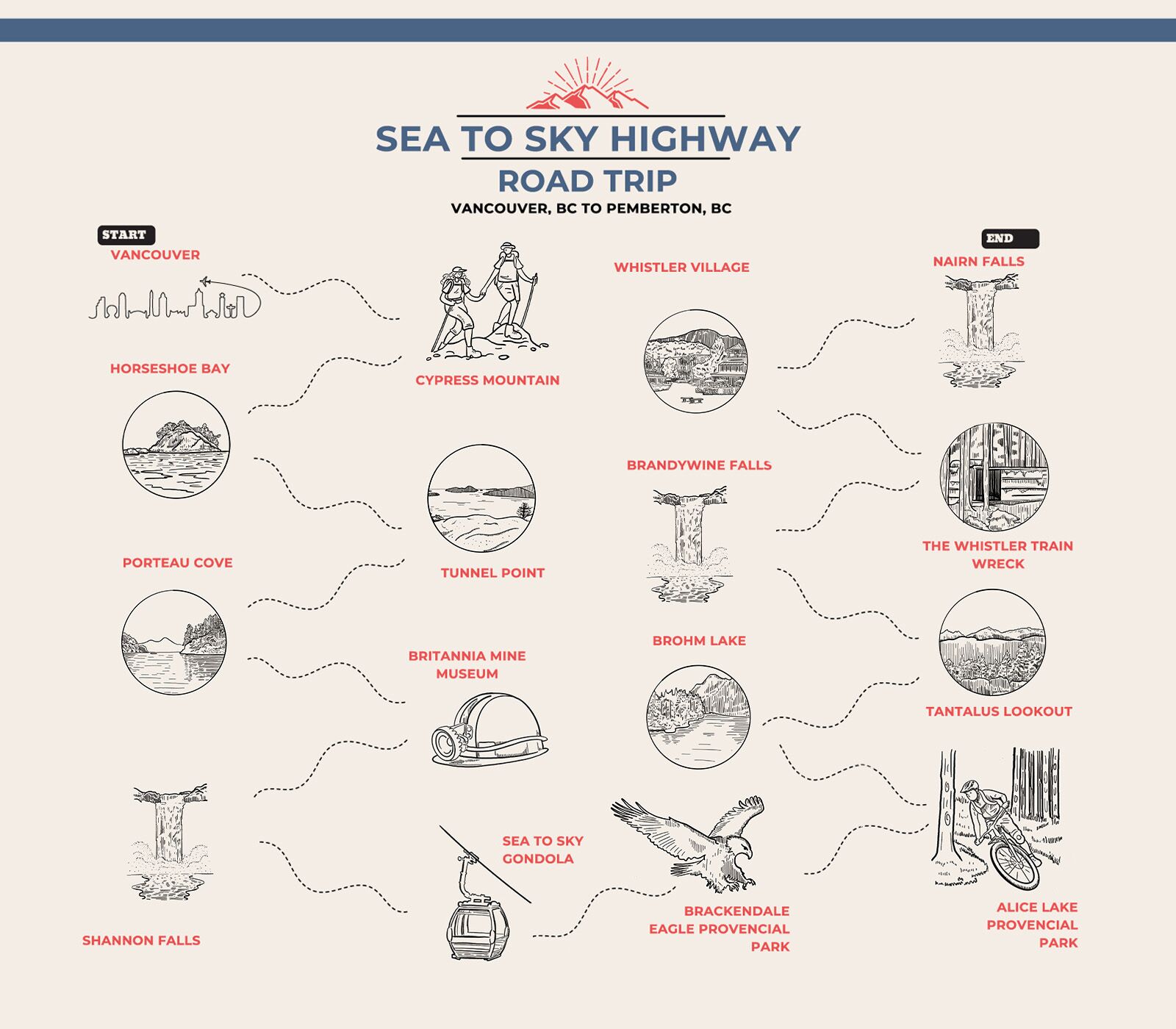
Photo: Matador Network
Start: Vancouver
Vancouver deserves plenty of time to explore — but when you’re ready to leave, jump on the Sea to Sky Highway going north.
Stop 1: Cypress Mountain
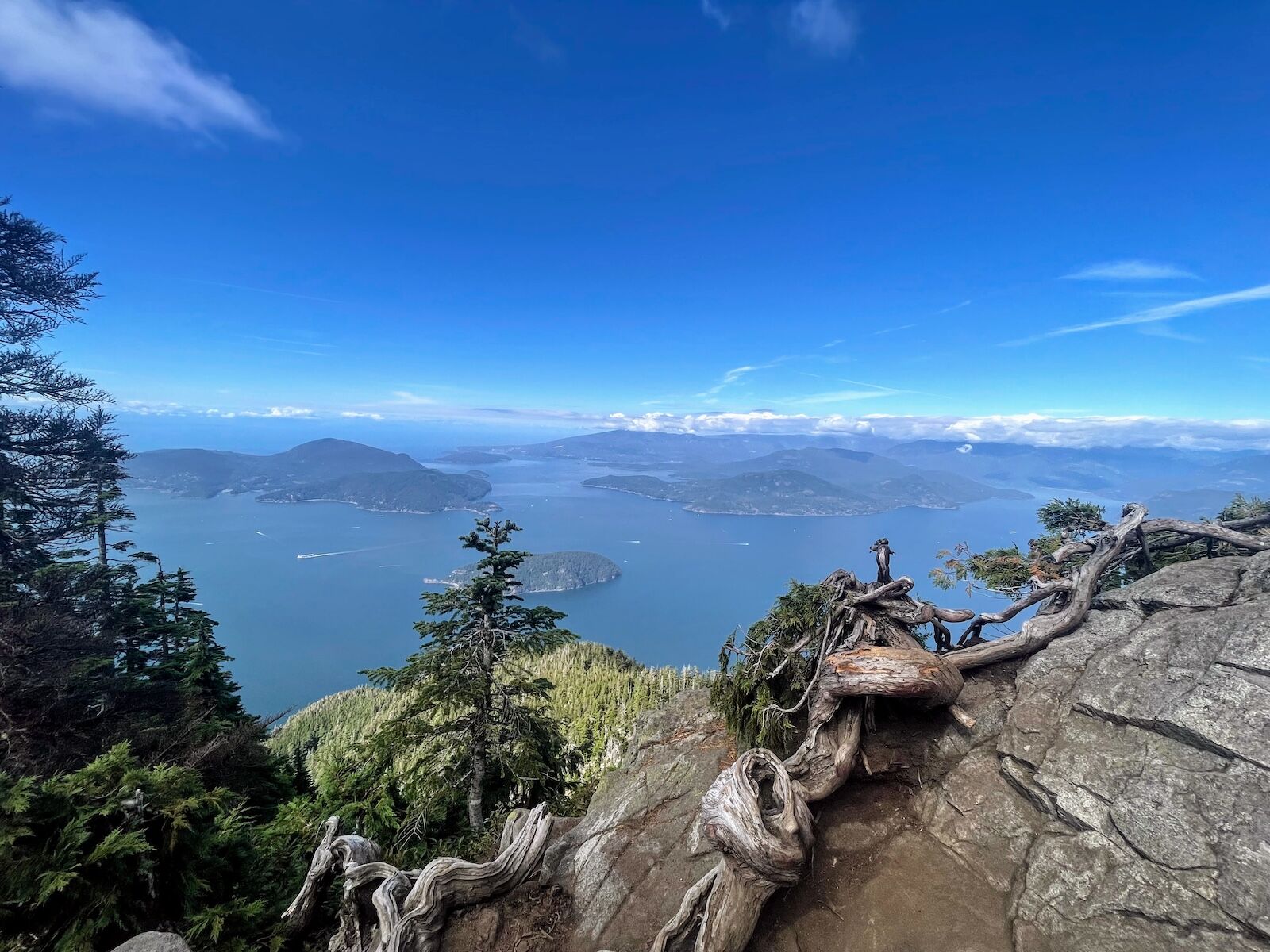
The view from a Cypress Mountain trail. Photo: Suzie Dundas
Hikers will likely want to make a stop at Cypress Mountain. It’s a ski resort in the winter but turns into a hub for hiking trails in the summer. The trails offer some of the most dramatic views near Vancouver, with routes that climb through dense coastal forests to high-elevation lookouts. A popular one is the Eagle Bluffs Trail, a five-mile out-and-back hike with an elevation gain of approximately 1,870 feet. It begins at the Black Mountain trailhead, ascends steeply through a mix of Douglas fir and western hemlock, then reaches exposed bluffs with panoramic views of Lion’s Bay and the Howe Sound.
Stop 2: Horseshoe Bay Beach Park
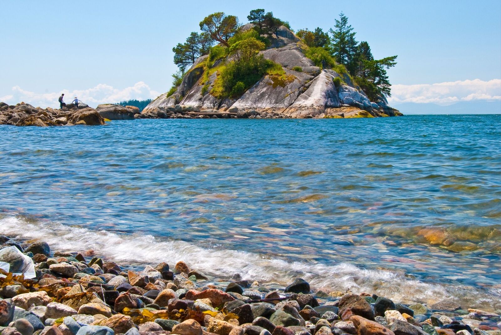
Horseshoe Bay Beach, just outside Vancouver BC. Photo: karamysh/Shutterstock
Horseshoe Bay Beach is a natural stopping point along the Sea to Sky Highway, offering a quiet contrast to the surrounding mountain landscapes. The pebble-covered shoreline provides views of Bowen Island and the ferry routes that connect the mainland to the outer Gulf Islands. While it’s a bit too cold for swimming, it’s pretty as can be, and The Lookout in the nearby village of Horseshoe Bay is a great place to stop for coffee and a pastry on morning trips.
Stop 3: Tunnel Point
View of the Sea to Sky Highway around Tunnel Point. Photo: Destination British Columbia
Tunnel Point Lookout, just north of Lions Bay on the Sea to Sky Highway, offers a stunning view of Howe Sound’s fjord-like geography and the surrounding coastal mountains.
The pullout is small, with limited parking, but provides an unobstructed view of Bowen Island and the inlets that define this stretch of coastline. It’s a quick stop for drivers, though since it’s on the left side of the road, it may be easier to hit it on your way back to Vancouver. (You can do it while going north — just be sure to use your turn signal.)
Nearby is the popular Tunnel Bluffs hike, starting across the street. It’s a much longer hike that will take several hours, but goes to a beautiful lookout point known as Tunnel Bluff.
Stop 4: Porteau Cove Provincial Park
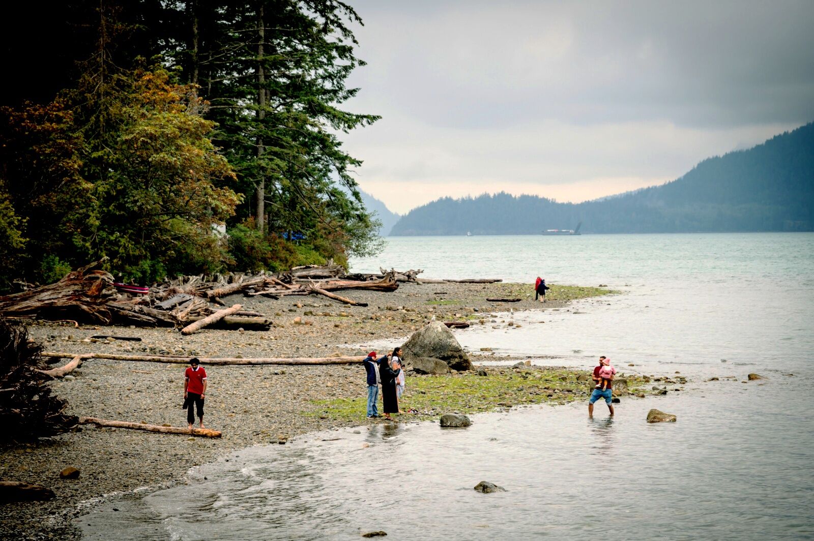
Photo: David Buzzard/Shutterstock
Porteau Cove Provincial Park is one of the few accessible waterfront stops along the Sea to Sky Highway, offering direct access to the Howe Sound. It was originally a ferry terminal but is now a small park with a boat launch, picnic areas, and a popular campsite. The shoreline is rocky, with driftwood scattered along the edge. Plus, the decommissioned pier is an excellent place for photography (leading lines, anyone?) or just sitting to admire the views for a bit. On clear days, you can see the Tantalus Range across the Sound — it’s especially beautiful in in winter and spring when snow caps the peaks.
The park is open 24/7 and has public restrooms, in case you just need a roadside break.
Stop 5: The Britannia Mine Museum
Scenes from the surprisingly fun Britannia Mine Museum complex. Photo: Suzie Dundas
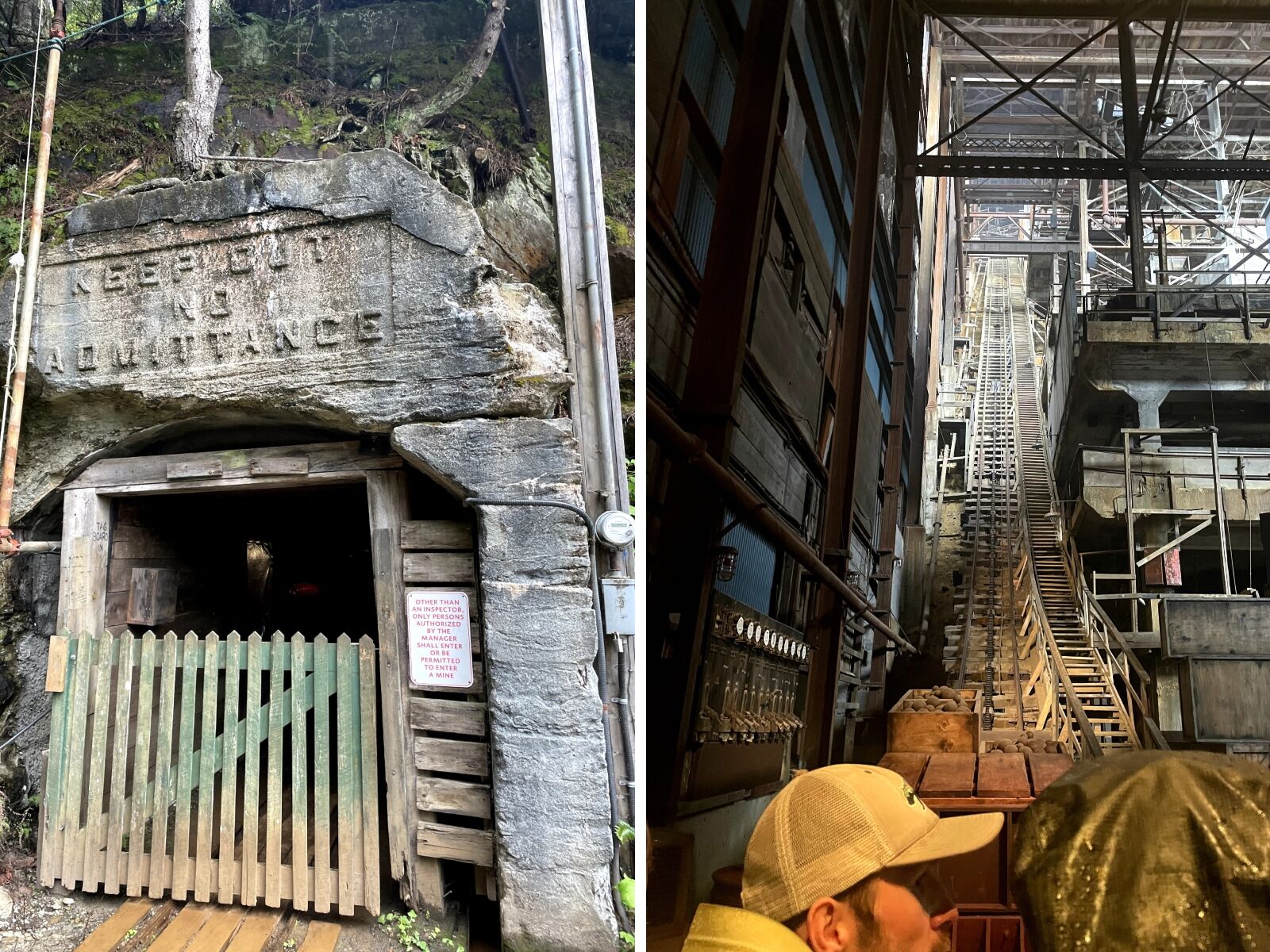
The Britannia Mine Museum, just off the Sea to Sky Highway south of Squamish, offers a glimpse into British Columbia’s mining history in a setting that still bears the marks of its industrial past. It was once one of the world’s largest copper mines, and the site preserves many of the original buildings, including the massive mines themselves.
The most immersive experience is the underground mine tour, where visitors ride a rail cart into a historic tunnel while guides demonstrate early 20th-century mining techniques. The building is 20 stories of rusted steel and weathered wood, making it one of the most recognizable landmarks along the highway. Inside, there’s an impressive high-tech show, illustrating the scale of the operations that once took place here.
Beyond the main attractions, the museum grounds feature hands-on exhibits, including gold panning stations and a collection of old mining equipment, plus science-based exhibits on the damage caused by the mine and the ongoing efforts to restore the environment. There’s also a small coffee shop, a large gift shop, and rotating exhibits on loan from around British Columbia. It’s open daily and tickets for adults are $42 CAD.
Stop 6: Shannon Falls
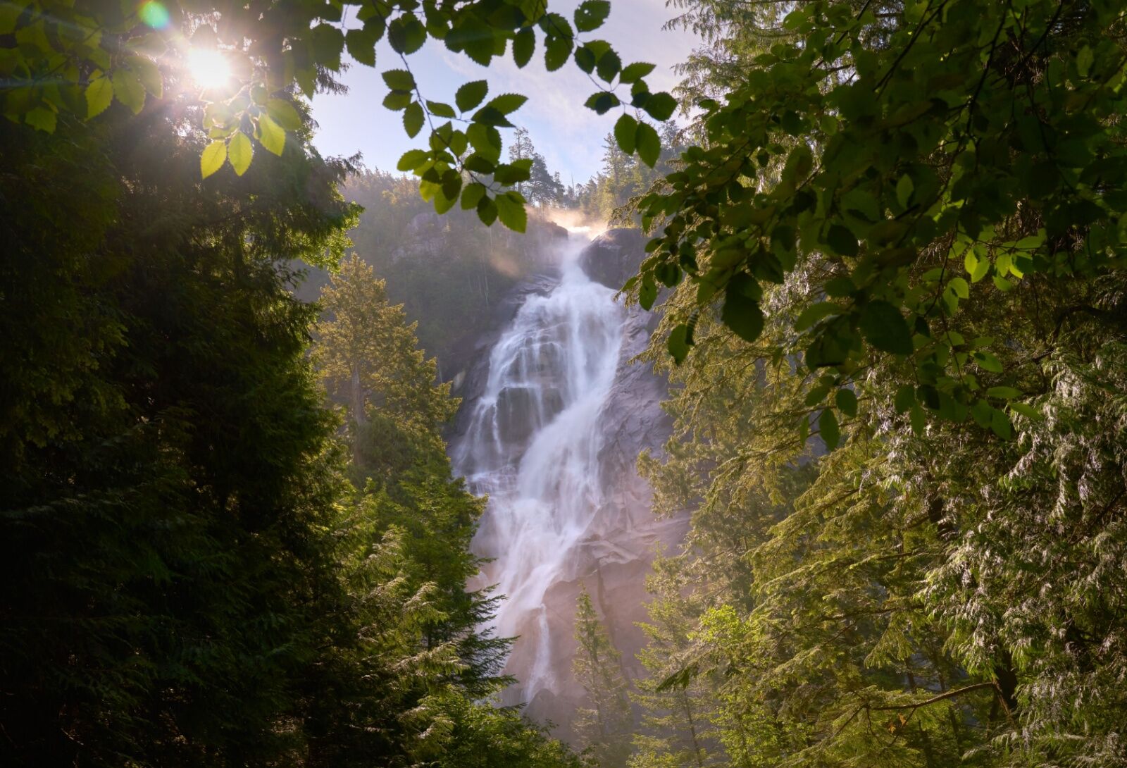
Photo: Max Lindenthaler/Shutterstock
Shannon Falls Provincial Park is a brief but worthwhile stop along the Sea to Sky Highway, especially as it allows you to see one of British Columbia’s tallest waterfalls without any strenuous hiking. The falls drop 1,105 feet down a series of smooth granite cliffs. It’s most powerful in spring and early summer with snow melt, but flows year-round.
A short, well-maintained trail leads to the base of the falls, with a few well-maintained dirt trails to viewpoints. The area has a cool, damp atmosphere, even on warm days, and is a gorgeous place for some cheesy group photos — especially in the lush pockets of forest surrounding the falls. Dogs are welcomed, but should be on leash.
Stop 7: The Chief
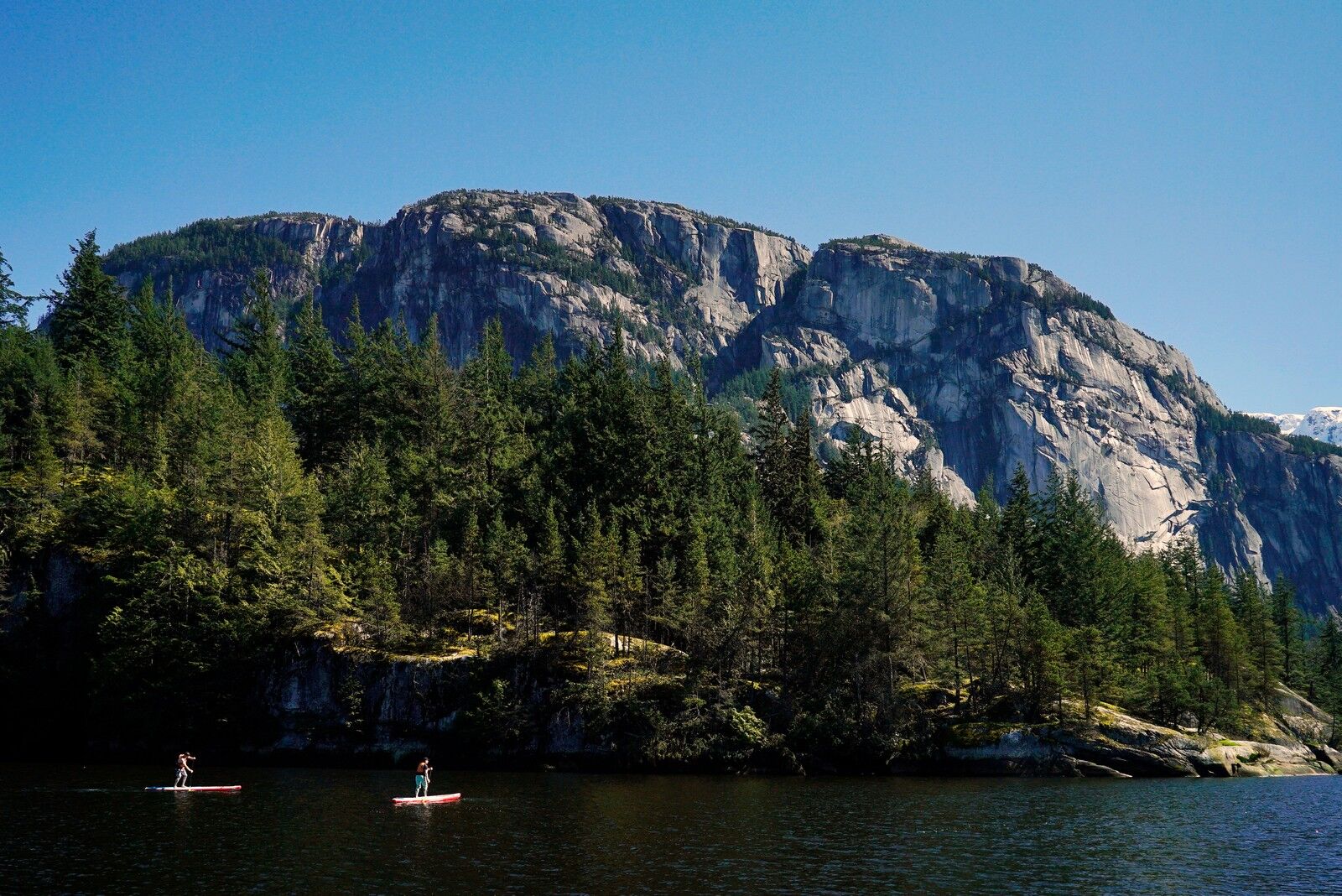
Photo: Explore Squamish
Stawamus Chief, a.k.a “The Chief,” is sheer granite monolith that towers over Squamish. It’s both a natural landmark and a test of endurance for hikers, climbers, and even the occasional professional mountain biker. It rises more than 2,000 feet above the valley floor and is usually dotted with rock climbers most days. Near the base, bouldering is popular, and a series of winding walking paths will lead visitors in and our of the forest, passing groups of climbers and chalky rock faces on the way. Interestingly, the Chief’s vertical walls are part of the same geological formation as Yosemite’s El Capitan.
There’s a huge parking area at the base, often filled with vanlifers in the summer months, and even a longer path that connects the Chief to Shannon Falls. Uphill hikers can undertake a challenging hike to the top, but you’ll find plenty of people and dogs just hanging out around the base and exploring the flat trails at the bottom year-round.
Stop 8: The Sea to Sky Gondola
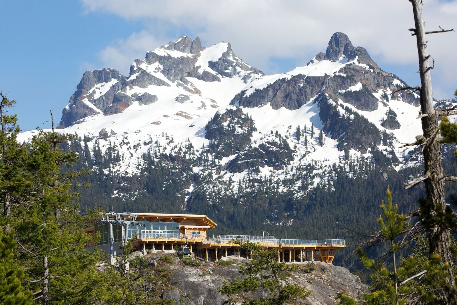
The Sea to Sky Gondola. Photo: Destination British Columbia/Sea to Sky Gondola/Paul Bride
The Sea to Sky Gondola is the most accessible way for non-hikers to take in the near-endless vistas offered by the Coast Mountains. It’s a gondola that carries visitors nearly 3,000 feet above sea level to the summit of The Chief. At the top, a network of trails and viewpoints extends beyond the main lodge. There’s the “Sky Pilot Suspension Bridge,” multiple viewing decks, and several walking trails. The most popular are the Panorama Trail to an open viewpoint, and the Spirit Trail, which is more of a quieter walk through the forest. The lodge itself has a cafe, gift shop, outdoor deck, and fire pits, and fire pits. It’s open year-round, though of course, the views can be obstructed on cloudy or snowy days.
Tickets for adults start at $68 CAD for round trip, but you can hike up and just take the gondola back down for $19.
Optional: Sunny Chibas and/or Raincity Distillery

Photo: Suzie Dundas
Okay, it’s certainly not the fanciest place in Squamish — but if you’ve been active all day and worked up an appetite, I simply adore the spicy cauliflower banh mi (with fries, naturally) from Sunny Chibas. It’s a one-of-a-kind place that set up shop a few years ago inside a former fast food restaurant. But don’t worry: as soon as you walk in, you’ll know it’s not your average McDonalds. It’s extremely popular, so order online or be prepared for a wait if you go any time around lunch or dinner.
And if you’re on the hunt for creative cocktails, complete with mushrooms and smokey finishes (and, I’m pretty sure, some kind of mozzarella-infused booze last time I was there), swing by Raincity Distillery. It’s semi-hidden in an industrial park but is worth the very short detour.
It should go without saying, but consider staying in Squamish if you’re planning on sampling the spirits.
Stop 9: Brackendale Eagles Provincial Park
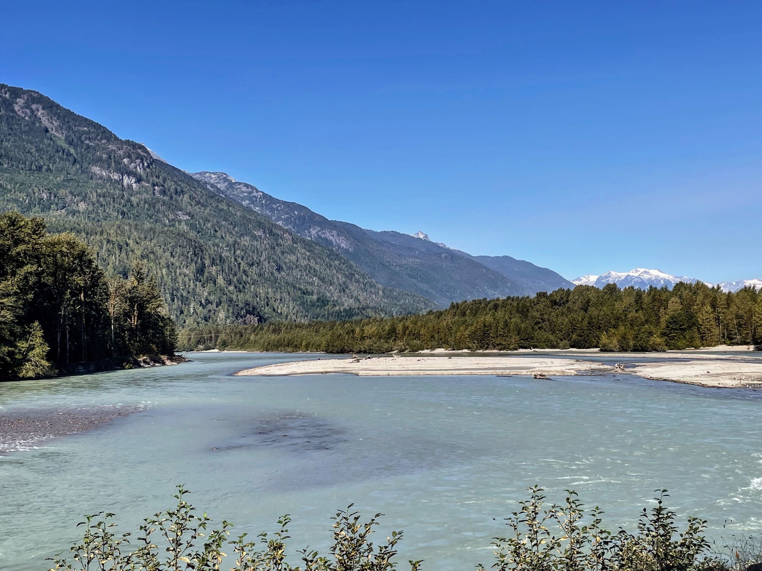
Photo: Suzie Dundas
Brackendale Eagles Provincial Park, just north of Squamish, is one of the most remarkable places to see bald eagles in North America. From around November to January, more than 1,000 eagles regularly gather along the Squamish River, drawn by the late salmon run. But even outside of the eagle season, you’re still likely to see a few hanging around, especially if you’re patient. The estuary also draws harbor seals, which you can often find by looking for their dark eyes just above the waterline as they scan for fish.
There’s a popular bar and restaurant with an outdoor deck (The Watershed Grill), and a level, wide walking path along the river. There’s even a local Facebook page where volunteers post updates about eagle sightings during the winter.
Stop 10: Alice Lake Provincial Park
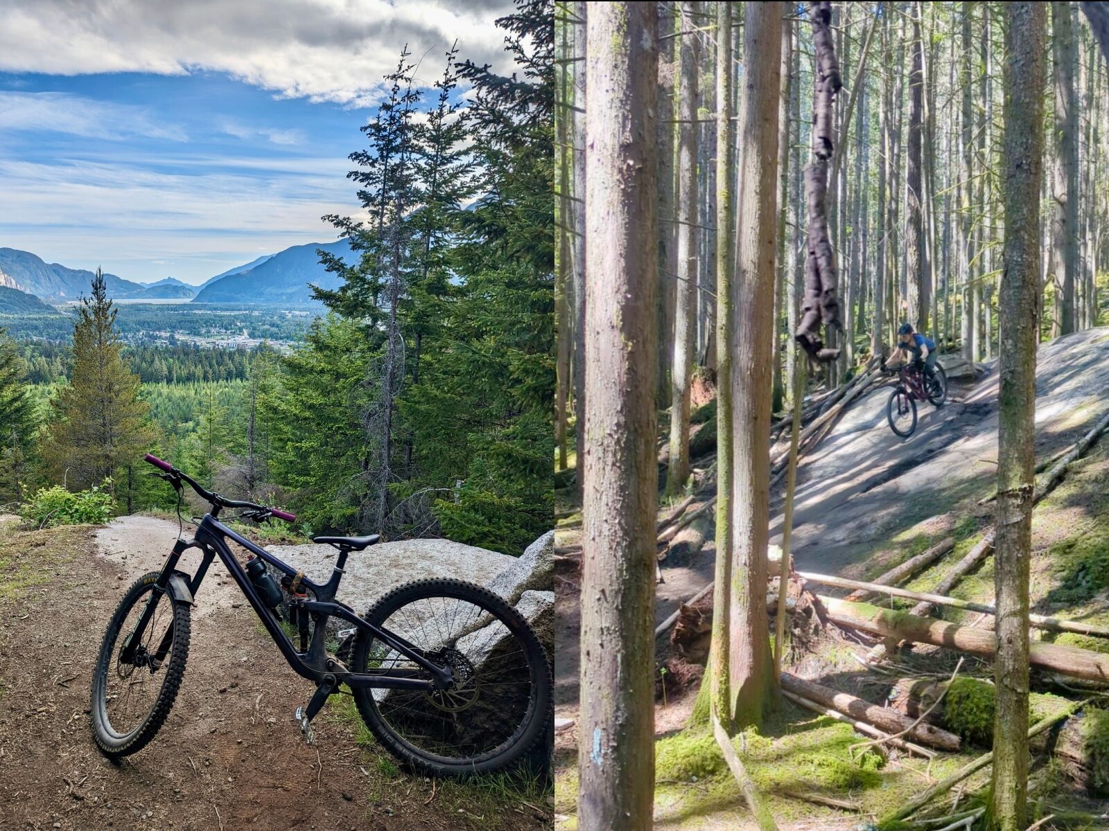
Photo: Suzie Dundas
Mountain bikers who know what they’re doing will want to explore the trails at Alice Lake, where black-diamond trails like Rupert and Pamplemousse provide examples of some of finest slab and feature riding in BC. Beginners will want to stick to flatter trails like Jack’s Trail. If you don’t bike, you still may want to post up at the beaches at Alice Lake, or even spend the night at one of the park’s pretty forested and lake-view campsites.
Stop 11: Brohm Lake
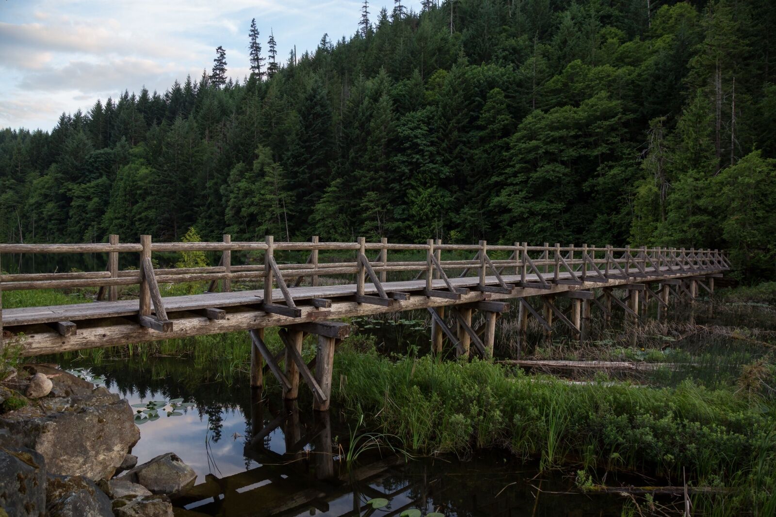
Photo: EB Adventure Photography/Shutterstock
Brohm Lake, just north of Squamish, is an easy detour off the Sea to Sky Highway, offering a quiet stretch of water surrounded by forest and rocky bluffs. A looping trail follows the shoreline and weaves through second-growth trees and past small cliffs where swimmers and paddlers often hang out in the warmer months. Unlike the glacier-fed lakes farther north, Brohm is warmer, though it’s never warm by tropical beach standards.
While the park is certainly popular, it sees far fewer visitors than Shannon Falls or The Chief, making it a good place for a slower-paced stop.
As of May 2024, the wooden bridge across Brohm Lake was closed. So before you go, check on the current status and have a backup hiking plan, as it’s unknown when it’ll be repaired.
Stop 12: Tantalus Lookout
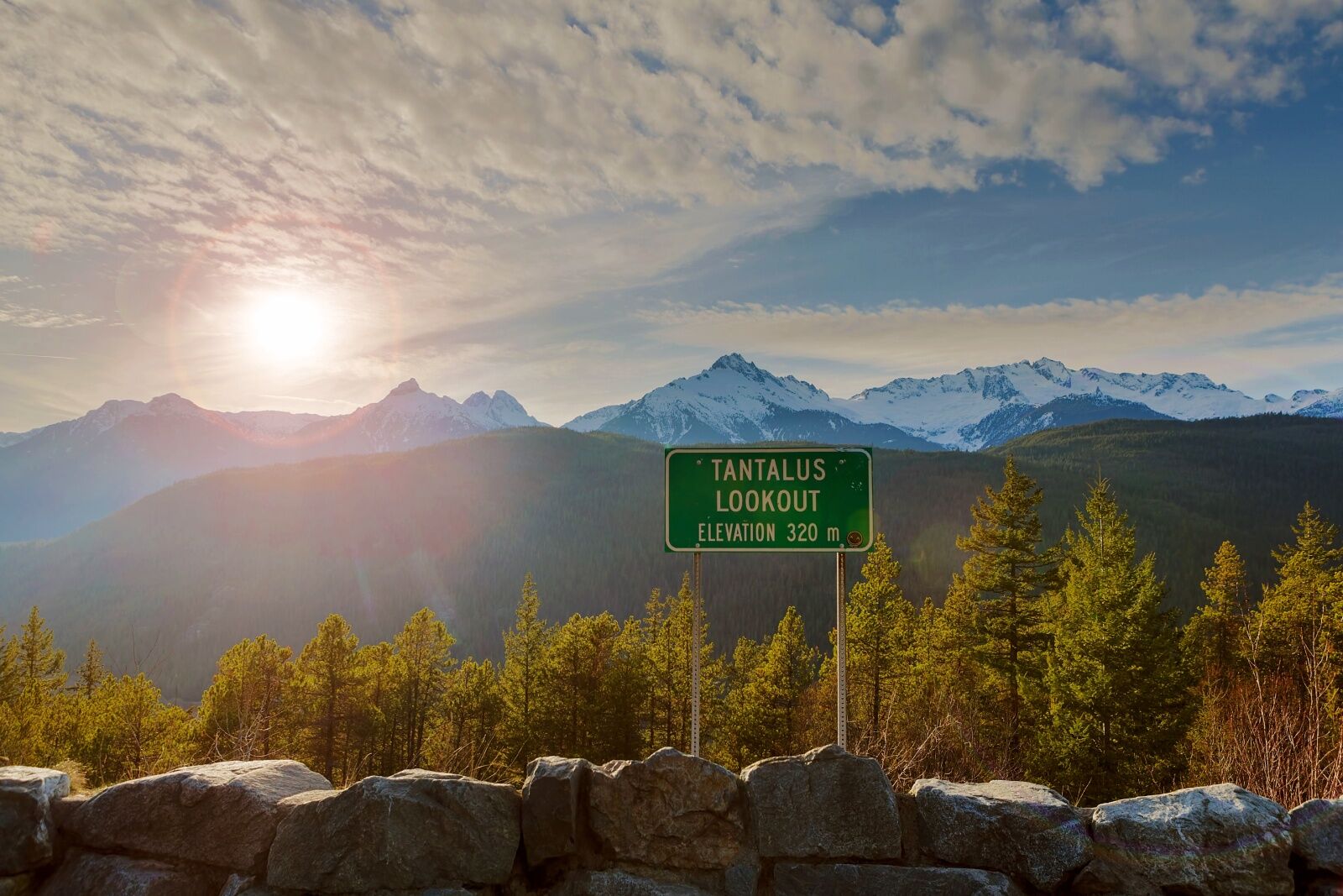
Photo: Thye-Wee Gn/Shutterstock
The Tantalus Lookout, very close to Brohm Lake, is an easy roadside pullout with unobstructed views of the Tantalus Range. The jagged, glaciated peaks are a stark contrast to the cliffs below and mark the unofficial beginning of the elevation gain as you leave Squamish and start climbing toward Whistler. On clear days, the icefields can catch the light and almost look like they’re sparkling in the distance.
The lookout itself is a simple pullout with a few interpretive signs, but it’s one of the better places to stop and take in the scale of the landscape without a long hike.
Stop 13: Brandywine Falls
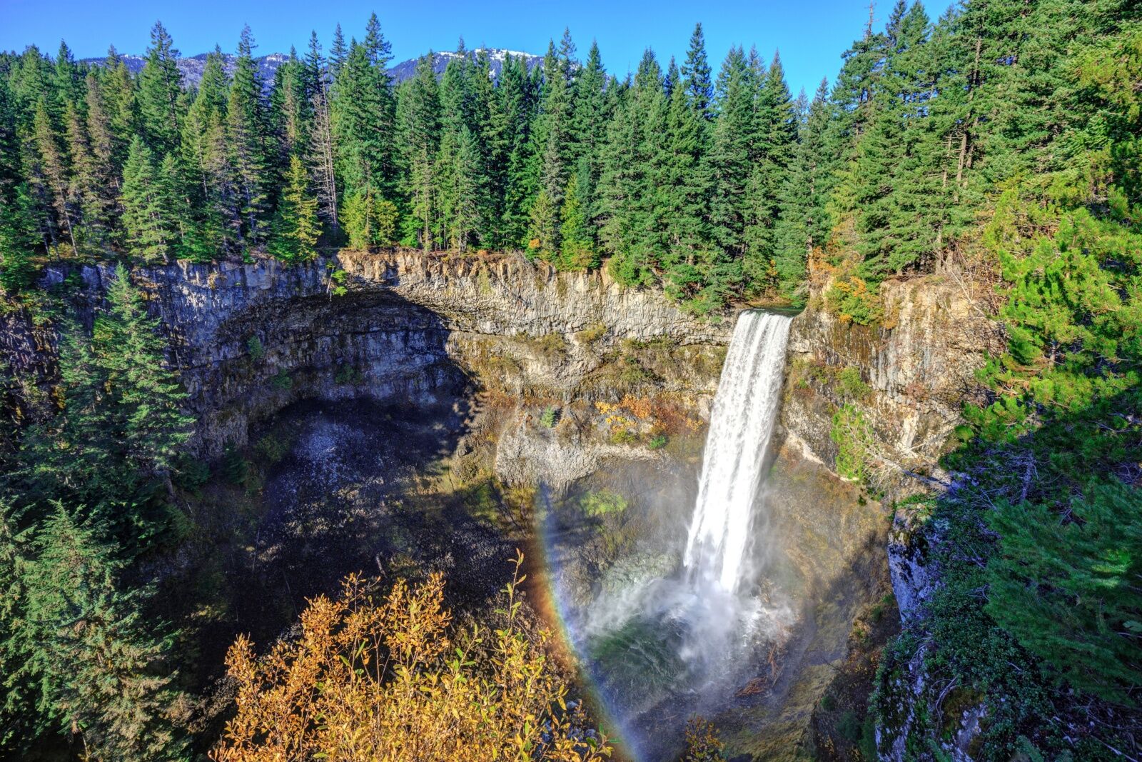
Photo: JamesChen/Shutterstock
The Brandywine Falls Trail in Brandywine Falls Provincial Park is a short, easy walk to one of the most dramatic waterfalls along the Sea to Sky Highway. The round trip trail is only .6 miles long and gains less than 50 feet in elevation, making it more of a walk you can do in flip-flops than an actual hike. However, you do get to stroll along a lovely path past fir trees and moss-covered rocks.
The viewpoint is on the edge of a cliff overlooking the falls, which plunge 230 feet in a near-perfect vertical drop before continuing through the narrow canyon carved by eons of water movement. On a very clear day, you can sometimes even see Black Tusk in the distance — the jagged, volcanic peak that dominates the skyline between Squamish and Whistler. Considering how short the walk is and what a stunning viewpoint it opens to, it’s a must-stop on any Sea to Sky Highway road trip.
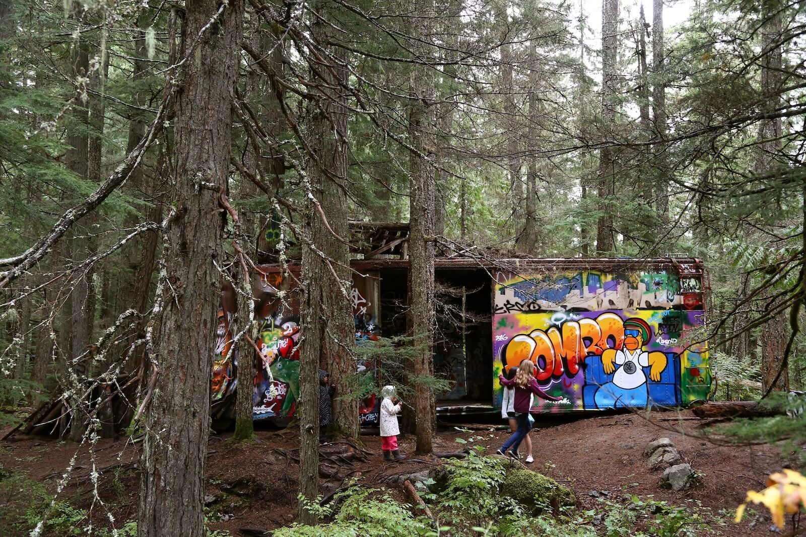
Stop 14: The Whistler Train Wreck
The Train Wreck near Function Junction in Whistler. Photo: Destination British Columbia/BC Ale Trail
The Whistler Train Wreck Trail is a short but worthwhile detour just south of the town’s Function Junction, offering an unusual mix of history, graffiti-covered ruins, and dense coastal forest. It’s a short trail, making it a great place to get out and stretch your legs (or your dogs legs, if you’re traveling with a dog in tow, like I do). It’s one of the easiest hikes around Whistler, at only 1.2 miles round trip and roughly 100 feet of elevation gain.
The trail runs along an easy-to-follow path through old-growth trees before crossing a suspension bridge spanning the Cheakamus River. On the other side, you’ll find a series of rusting boxcars, left in situ after a 1956 derailment. Over the years, they’ve been claimed by local artists, and every reachable surface is covered in layers of graffiti. Despite being so close to Whistler, it feels fairly remote, and is a great place to get a sense of how peaceful the forest can be without straying too far off the Sea to Sky Highway. Parking is on Whistler Quarry Road, making it only about a two-minute detour.
Stop 15: Whistler Village
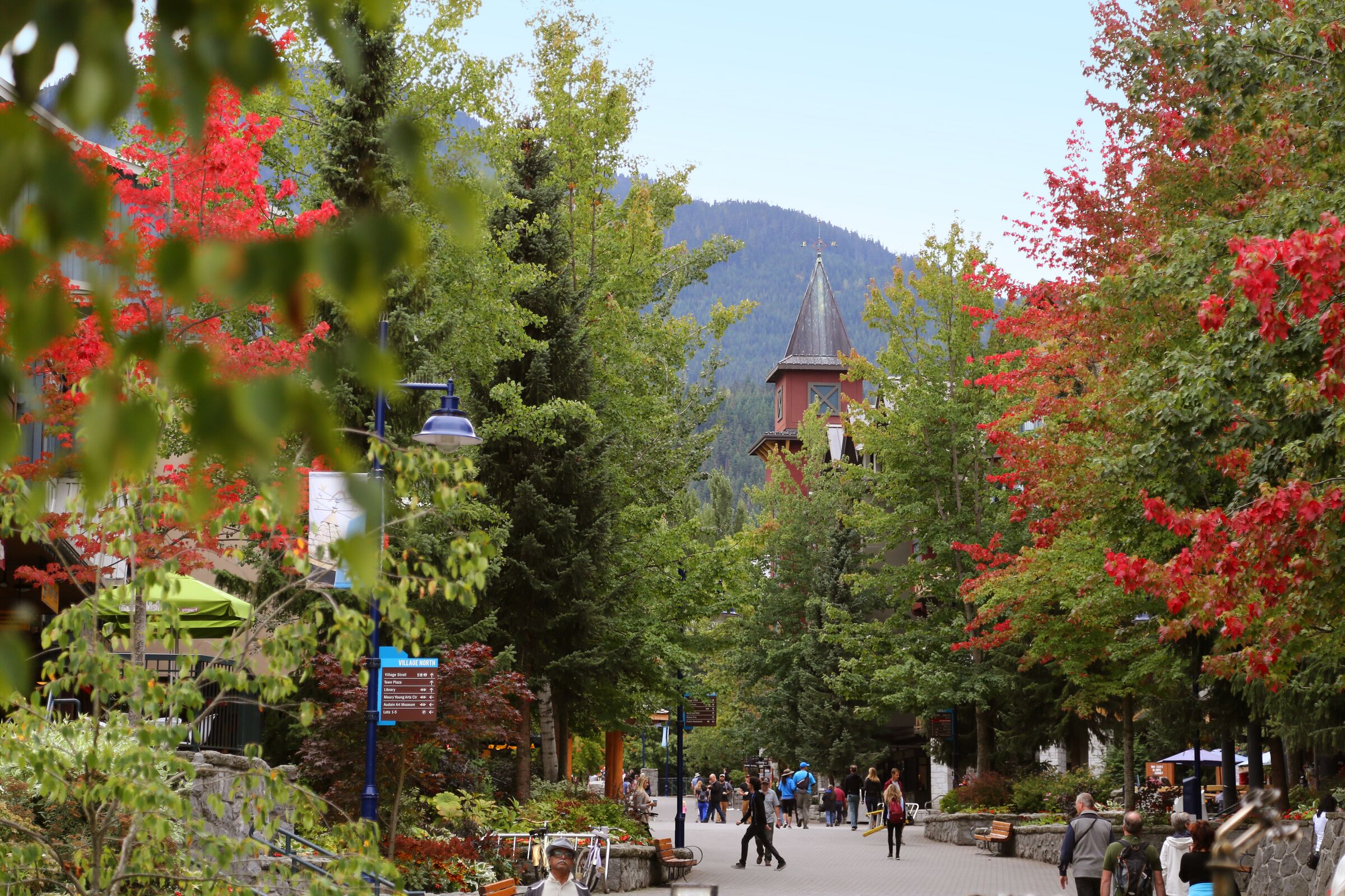
The Train Wreck near Function Junction in Whistler. Photo: Destination British ColumbiaBC Ale Trail
Whistler Village is a natural stop along the Sea to Sky Highway, where mountain wilderness meets a lively alpine town. Though sprawling, the village is designed for walking, with wide, winding pathways lined by timber-and-stone buildings, patios spilling onto plazas, and mountain views at nearly every turn. Even a short stop allows for a walk through Whistler Olympic Plaza, a visit to the Audain Art Museum, or a quick trip to browse the fascinating stories and exhibits at the Squamish Lil’wat Cultural Centre. In the village, you’ll find everything from cheap ramen to luxury restaurants (many of which have off-season specials).
Despite its reputation as a winter destination, the village hums year-round, and it’s hard to go there and not feel the energy of a place full of passionate, happy people. I love Whistler for the world-class bike park, but I’m just as happy there strolling with my dog through the village or running out for a hot coffee in the morning.
Also very close to Whistler is the Whistler Scandi Spa, offering multiple hot and cold pools for the perfect Nordic plunge experience. If you’d rather be more active, Lost Lake is walkable from Whistler Village. A wide, packed-gravel trail winds through tall pines and firs, leading to the lake’s shallow waters. In summer, the beaches draw swimmers and paddleboarders, while wooden docks offer places to sit and take in the view. The trail network around the lake is extremely popular with hikers, bikers, and snowshoers, making it a popular place whether you’re on or off the water.
Stop 16: Nairn Falls
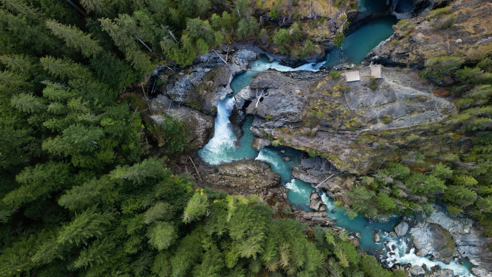
Photo: Wirestock Creators/Shutterstock
Nairn Falls Provincial Park, just south of Pemberton, isn’t the biggest park in the area, but its most well-known claim to fame is certainly worth seeing: Nairn Falls. The 1.5-mile round-trip trail leads to a rushing, 197-foot-tall waterfall, following the turquoise water of the Green River in the process. It’s straightforward and easy to follow with slight up and downs but nothing too strenuous. Parking is just off the Sea to Sky Highway, near the Nairn Falls Campground.
Next: Pemberton and beyond
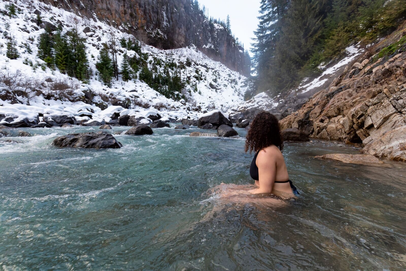
Keyhoe Hot Springs near Pemberton. Photo: EB Adventure Photography/Shutterstock
You’ll be in Pemberton just a few minutes after leaving Nairn Falls. Pemberton is the unofficial end of most Sea to Sky Highway roadtrips, but you can continue further north into the mountains to reach destinations like Joffre Lake, Duffey Lake, Rogers Creek, Seton Lake, or Lillooet. After Pemberton, lodging and dining options along the route start getting a loss fewer and farther between, so make sure to plan where to stay, fuel up, and dine before heading further north. ![]()